
Things to do in Karamay
Explore top experiences
Top 10 attractions in Karamay


World Mystery Town
World Mystery Town is located in Urho District, Karamay City, on the northwestern edge of the Junggar Basin, adjacent to National Highway 217, which connects Karamay to Burqin. Most travelers on the Northern Xinjiang loop route make a stop here. The area features typical yardang landforms, where billions of years of wind erosion and water immersion have carved the Gobi into towering, irregularly shaped mounds resembling a deserted ancient city from afar. The attraction lies in a wind-prone area, with strong winds throughout the year. Locals also call it "Urho Wind City," with a saying that goes, "One annual wind blows from spring to winter." When the wind howls through the labyrinth of mounds, it produces eerie wails, especially at night, earning it the name "Devil's Town." In 2005, when China National Geographic selected the most beautiful landscapes in China, the yardang landforms here were listed alongside those in Dunhuang and Lop Nur, becoming one of the representative views of yardang formations in the country. Among the earthen mounds in the Gobi, some resemble castle towers, while others look like people or animals. The attraction has named the most distinctive ones, such as "Sphinx," "Tiananmen," "Great Front Gate," "Guilin landscape," and "beacon tower." The "Devil's Eye" at the entrance is a iconic photo spot. When the small train rounds a bend, you can also see a massive rock that appears as a human face from the front but changes to another face when viewed from behind, known as the "Devil Couple." The attraction covers a vast area, with sightseeing trains as the main mode of transportation. Stops along the route include the Sphinx, filming locations for Seven swords and Crouching tiger, hidden dragon, Dinosaur Valley, and other sites, with onboard guide available. Movies and TV shows like Crouching tiger, hidden dragon, Seven swords, Visitors on the icy mountain, and Hero were filmed here, and sculptures recreating movie scenes remain at each stop for fans to spot familiar frames. A boardwalk near the Seven swords station leads to a viewpoint overlooking the entire yardang formation, while camel rides for photos are available near the Sphinx area. Each stop has limited time, but there's no need to rush if you want more photos—just wait for the next train. A full loop takes about two to three hours. At sunset, the slanting rays turn the mounds warm gold with distinct light layers, making it prime photography time. However, the desert has strong winds and intense sunlight, so remember to bring windproof gear, sunscreen, and drinking water.Karamay · 90.2km from downtown

Dushanzi Grand Canyon
Dushanzi Grand Canyon is located in Dushanzi District, Karamay City, Xinjiang, about 28 km south of the urban area, with accessible roads for vehicles. The canyon floor is 100–400m wide, while the canyon shoulders span 800–1,000m. With a height of up to 200m from base to shoulder and an elevation of 1,070m, this attraction features spectacular canyon terrain. After breaking through the Tianshan Mountains, the river carved out a spectacular canyon in the sloping plains southwest of Dushanzi. The terraces on both sides of the canyon are clearly visible, with at least nine distinct levels. The terrace surfaces feature desert grasslands dotted with wormwood and feather grass. Within Dushanzi, the Kuitun River flows through the Dushanzi Grand Canyon, which runs nearly north-south. The canyon walls are steep cliffs, while the river at the bottom alternately converges and diverges. The canyon shoulders are covered in desert grasslands. Standing at the canyon's edge, visitors are treated to a classic grand canyon panorama. The meltwater from Tianshan Mountain and rainwater carve out these unique canyon views by forming alluvial gullies through the local soil. The canyon begins at the mountain's base, creating distinct soil layers across the grassland, primarily in shades of gray and black. Though fed by abundant snowmelt, the water turns turbid as it carries sediment through these mineral-rich soils.Karamay · >100km from downtown

Duku Highway
Duku Highwayis the common name for the Dushanzi to Kuqa section of National Highway 217. It starts in the north at Dushanzi and ends in the south at Kuqa, the site of the ancient Qiuci kingdom. It spans approx. 561 km and runs through the Tianshan Mountains, cutting the travel distance between northern and southern Xinjiang, which originally required a detour of over 1,000 km, by nearly half. Half of the highway is at an altitude of over 2,000 m, and it crosses four mountain passes covered in snow year-round. One-fifth of the route lies in the alpine permafrost zone, and one-third consists of cliffs and precipices. It took ten years to build this road before it was fully opened to traffic. More than 100 soldiers who built the road rest forever in the Tianshan Mountains, and the Martyrs' Cemetery in Qiao'erma was built to commemorate them. It can be said that every kilometer was hard-won.China · Kuytun

Black Oil Mountain
Black Oil Mountain is located northeast of Karamay, just over two kilometers from the city center. It appears as a low hill with a relative height of only 13 meters, covering an area of approximately 0.2 square kilometers. The entire hill is black with an uneven surface, composed of sandstone soaked in oil or conglomerate cemented by petroleum. Due to the evaporation of volatile components in the oil, large areas of the surface appear dry. "Karamay" means "black oil" in Uyghur, which is how this natural asphalt mound got its name, Black Oil Mountain. This black asphalt hill and the oil buried beneath it have been dormant here for hundreds of millions of years. The hill has multiple oil springs, forming numerous small oil pools with continuously bubbling crude oil that is thick and jet-black in color. At the top of the hill stands a 2.5-meter-tall granite monument erected in 1982, shaped like a cone, with the inscription "Black Oil Mountain" carved on its front. Black Oil Mountain boasts extraordinary scenery, bordered by the Devil City to the east, the Manas River Xiaoguai Oasis to the west, and backed by Genghis Khan Mountain. Nearby, a Black Oil Mountain Park has been established, featuring a small pavilion on an isolated island within the park. Beside the pavilion stand three rare and precious pine tree fossils dating back over 200 million years. To honor the spirit of hard work and entrepreneurship, the Xinjiang Petroleum Administration Bureau and Karamay City erected a nearly 3-meter-high stone monument on October 1, 1982, along with a statue of a senior Uyghur man playing a rawap while riding a donkey.Karamay · 4km from downtown

Primitive Populus Euphratica Forest
There are nearly 300,000 mu of Populus euphratica forests in Wuerhe District, mainly including the original Populus euphratica forests between Baikouquan and Wuerhe City, the Populus euphratica forests in the Baiyang River Grand Canyon, and the Populus euphratica forests in the Gobi Desert between the World Devil City and Eric Lake. .Karamay · 86.1km from downtown

Duku Highway Starting Point (Dushanzi)
Dushanzi, as the northern starting point of the Duku Highway, is located on the west side of Karamay City, Xinjiang, at the northern foot of the Tianshan Mountains and the southwestern edge of the Junggar Basin. This small town, which rose up because of oil, is not only a transportation hub connecting southern and northern Xinjiang, but also the gateway to the magical journey of the Duku Highway, "seeing four seasons in one day, and different weather in ten miles". Its unique geographical location, magnificent natural scenery and profound oil culture make it a pilgrimage site in the hearts of self-driving enthusiasts. Driving south from the starting point, you will soon reach the "Gate of Tianshan" viewing platform, which is a barrier to entering the Tianshan Mountains. You can overlook the snow-capped mountains and the Duku Highway, which is like a black dragon winding into the distance. The scenery is shocking. Dushanzi is not only the geographical starting point of the Duku Highway, but also the spiritual starting point for exploring the magnificent scenery and cultural history of Xinjiang. Starting from here, crossing snow-capped mountains, canyons, grasslands and lakes, every kilometer is writing the legend of the north and south of the Tianshan Mountains.Karamay · >100km from downtown

Sunset Sightseeing in Karamay
Karamay attracts countless tourists with its unique natural scenery and cultural landscape. Whether standing on the high-rise buildings in the city or strolling on the vast Gobi Desert, you can enjoy the stunning sunset in Karamay. In the World Devil City, as the sun gradually sets, the golden sunlight shines on the various shapes of Yadan landforms, and the entire scenic area seems to be coated with a layer of golden light, which is particularly spectacular. In particular, the filming location of "Crouching Tiger, Hidden Dragon" is one of the best places to watch the sunset. It is recommended to arrive early and choose a high viewing platform to better capture the beauty of the sunset. The rippling water of the Erik Lake and the overgrown reeds complement the Devil City mound in the distance. At sunset, the afterglow of the setting sun shines on the lake, and the entire lake becomes colorful and beautiful. Since the sunset time in Xinjiang is relatively late (usually around 8 pm), it is recommended to plan the itinerary and viewing location in advance.China · Karamay

Devil Couple
The Devil Couple is a pictographic attraction in Devil City. It is a rare stone with two faces. Whether it is eyebrows, eyes, face shape, or mouth, they are all so lifelike. You will be surprised by more than this. When tourists slowly pass by and look back at the huge rock again, on the left side of the huge rock, there is actually another human face, also staring at the east, but the face shape and expression are completely different from the previous one. Because the two faces look like one man and one woman, they are called the "Devil Couple".Karamay · 90.7km from downtown

Baiyang River Canyon
Baiyang River Canyon is a typical attraction featuring Yardang landforms and canyon scenery, with the river meandering through the valley in multiple bends. The area has eight water crossings along a 12 km self-driving route, offering a perfect blend of modern transportation and natural beauty. The riverbanks boast rich vegetation with 60% coverage, where poplar trees account for over 90% of the arboreal species. The valley walls on both sides are composed of Cretaceous light brownish-red mudstone and sandstone. The steep canyon walls stand majestically, carved by nature's craftsmanship, creating a breathtaking and refreshing sight. The Baiyang River originates from the Urkashir Mountains in western Xinjiang, meandering nearly 170 km from west to east before flowing into Lake Ailik. Along its banks, the scenery is diverse—featuring vast deserts, towering cliffs, and a stunning blend of arid landscapes, mountainous terrain, and clear blue skies. The 24-km Baiyang River Canyon, stretching from Baiyang River Reservoir to Karamay's Urho District, is particularly picturesque with its lush valley forests and winding river. Its notably cooler summer temperatures compared to surrounding areas make it an ideal destination in Karamay for sightseeing, rafting, and escaping the heat. The Baiyang River Canyon project covers a total area of 400,000 square meters, with 75,000 square meters of built-up space. It includes the Urho Comprehensive Visitor Center, the Dragon Bone Corridor attraction entrance, a riverside wilderness practice area, an outdoor camping zone, tourism service facilities, a mountaintop restaurant, the Qiming Tower, the Dragon Pearl Service Center, canyon reed marshes, Dragon Valley Forest, Dragon Mouth Wetland, Golden Silk Long Beach, and waterfront platforms. This project connects the Baiyang River Canyon attraction with other landmarks like the Qin Empire Film Studio, "Western Wuzhen," and the World Devil City, promoting Urho District's comprehensive development of a new tourism model where "major routes link minor routes that extend right to visitors' doorsteps."Karamay · 74.6km from downtown

Mud volcano
Not far to the southwest of Dushanzi, there is a mud volcano, bare, and the name of Dushanzi comes from this mud volcano. There are magma vents in the shape of a circle or an ellipse on the top of the mud volcano, and the mud accumulates in a cone shape on the ground. Some volcanic craters erupted violently, accompanied by a thudding sound. Mud volcanoes are rare natural features. The mud volcanoes here are still erupting continuously.Karamay · >100km from downtown
More things to do
Private Tours in Karamay
View More Private Tours in Karamay


Group Tours in Karamay
View More Group Tours in Karamay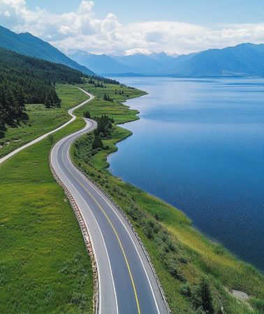
Free things to do in Karamay
Duku Highway
China · Kuytun
Karamay No.1 Oil Well
Karamay · 2.3km from downtown
Duku Highway Museum
Karamay · >100km from downtown
Karamay River Scenic Area - Jiulong Pond
Karamay · 4km from downtown
Ailik Lake
Karamay · 79.7km from downtown
Karamay River Scenic Area
Karamay · 1.7km from downtown
Karamay Big Oil Bubble
Karamay · 2.3km from downtown
Jinlong Lake Scenic Area
Karamay · 3.1km from downtown
The First Oil Well in Xinjiang
Karamay · >100km from downtown
What travellers say about Karamay

M31***008 October 2026
5.0
Karamay's World Devil City is a Yardang landform sculpted by wind and sand over millions of years. A ride on the scenic train through the Gobi Desert reveals uniquely shaped rock formations rising from the barren landscape. The wind howls through the ravines, giving the place its name, "Devil City." At sunset, the changing light and shadow bathe the hills in a warm gold, creating a desolate yet breathtaking scene. The area possesses a vast, wild atmosphere, perfect for photography. Remember to bring sun and wind protection; it's a must-see natural wonder on the Northern Xinjiang loop.
World Mystery Town

行走在民间的艺术家25 October 2026
5.0
Heading towards the vast wilderness of northern Xinjiang, the first magnificent stretch of the Duku Highway begins at the Dushanzi Grand Canyon. This hidden realm, stretching along the edge of the Junggar Basin, is a monumental fissure etched into the earth by the winds and snows of the Tianshan Mountains and the waters of the Kuitun River over millions of years, concealing the unique desolation and grandeur of Northwest China.
Upon first glimpse of the canyon, one is struck by its utterly primal awe. On the flat, boundless Gobi Desert, the earth abruptly breaks apart, a deep ravine plunging into the sky and stretching for tens of kilometers without end. A vertical drop of two hundred meters creates a breathtaking spectacle of cliffs; layers upon layers of sandstone and conglomerate walls are steep and rugged, covered with folds eroded by flowing water and wind, their intricate patterns resembling the earth's unfolding veins, or the countless strokes of time, rough yet powerfully imbued.
Layers of gray-black, yellowish-brown, and reddish-brown rock stacked upon each other on the cliff face are silent imprints of millions of years of geological changes. The nine-tiered, terraced landscape, eroded by wind and snow throughout the seasons and carved by rivers, imbues every inch of rock with the weight of time. Gone are the gentle embraces of verdant mountains and clear waters; here lies the rugged grandeur of the northern wilderness—desolate, magnificent, and majestic, a breathtaking natural beauty in its own right.
Standing on the viewing platform, the vast Gobi Desert stretches to the horizon, with the river meandering through the valley, its shallow flow gently smoothing the cracks in the earth. A long, howling wind sweeps across the rugged cliffs, dispelling all the anxieties of the journey. Beneath the blue sky and white clouds, the rugged canyon and the clear sky reflect each other; the vastness of heaven and earth makes one feel insignificant, and all worries are dissolved by the immensity of the mountains and rivers.
Dushanzi Grand Canyon is an epic masterpiece of nature, a testament to the grandeur of northern Xinjiang. Unadorned and unrefined, it stands against the backdrop of millions of years of history, its spirit defined by the vast wilderness and towering mountains. This initial journey to the canyon allowed me to understand the majestic vastness of Northwest China and encounter the most healing freedom and openness.
Dushanzi Grand Canyon

M54***5211 July 2026
4.0
Xinjiang Trip Day 9 ✨ Tangbula Hundred-Mile Gallery—Duku Highway—Urumqi
What incredible luck today! I woke up this morning to find out the Duku Highway was reopened! ✨ What would have been an 11-hour drive was reduced to just 8 hours! What amazing luck!
🌄 Surprise at the start: The Hundred-Mile Gallery is breathtakingly beautiful! Every snapshot is wallpaper-worthy scenery 🏞️
The Duku Highway truly deserves its title as Xinjiang's most beautiful highway 🏆 Today we witnessed:
✓ 20°C summer at the foot of the mountain vs. a sub-zero snowy world at the summit ❄️
✓ A changing panorama of scenery throughout the four seasons: grassland → spruce forest → snow-capped mountains → Danxia canyons
✓ A southerner screamed with excitement upon touching a real snow-capped mountain for the first time (I won't say who it was 😝)
🚗 Driving Tips:
1️⃣ Duku Highway Opening Hours: June 1st - October 15th
2️⃣ Restricted Hours: 8:00 AM - 7:00 PM
3️⃣ Essential Items: Thick coat! Sunscreen! Sunglasses! (Don't ask how I know, I just got three shades tanned 😭)
💯 Today's highlights:
A snowball fight at the foot of the snow-capped mountains ☃️ Zero traffic jams + zero livestock = a silky smooth experience
Still savoring the experience on the way back to Urumqi, this was definitely the most worthwhile day of my Xinjiang trip! I highly recommend that everyone visiting Xinjiang add the Duku Highway to their must-see list~
#XinjiangTravel #DukuHighway #HundredMileGallery #TangbulaGrassland #UrumqiTourism
Duku Highway

Anonymous user24 September 2026
5.0
The site where the first oil field was discovered in Karamay, though abandoned, is significant as a tourist attraction. Visitors can see the crude oil bubbling from the wells, which is quite interesting, and also get a sense of the once bustling oil extraction activity.
Black Oil Mountain

小李带您游新疆18 October 2025
5.0
After purchasing your ticket at the visitor center, those who enjoy hiking and have the stamina to spare can opt for the shuttle bus ticket. After arriving at the parking lot, walk about a kilometer to the left to reach the third shuttle bus stop, where you can enjoy camel rides. If you're curious, let the camel driver take you through the thousand-year-old poplar trees—a truly unique experience! The poplar trees in northern Xinjiang are in full bloom around National Day. Don't miss out!
Primitive Populus Euphratica Forest

M39***1627 July 2025
5.0
The temperature difference between morning and evening is large in Duku. It is cooler at night, about 20 degrees. You can enjoy the delicious food and beautiful scenery. The wonders of nature are fully displayed here. Come quickly. There will be no good scenery when it is cold.
Duku Highway Starting Point (Dushanzi)

山在穷游25 March 2020
5.0
How can you not visit the Devil Couple when you come to Devil City? There are many scenic spots along the way, but most of them are named because they are very similar in shape, such as the Sphinx and the Titanic. However, on a pile of earth, you can see two different figures from different angles. Such a masterpiece is really rare. After coming here, your vision will be broadened a lot. Looking at one earth ball after another and one shape after another, it is inevitable that you will sigh at the magic of nature.
Devil Couple

139***7311 June 2025
4.0
Here you can see the Yadan landform and Populus euphratica forest, and there are eight sections of road that pass through water. It is quite interesting to drive the car through the water. Compared with the Devil City, there are actually more things to see, Yadan landform + Populus euphratica forest + wetland + meadow, and the sunset is also very vast. The key is that there are very few people!!! The shuttle bus goes around for about an hour. When you want to stop, tell the driver that you can take pictures of the Populus euphratica forest as you like. There are few people and you have the freedom.
Baiyang River Canyon

M15***7812 May 2026
5.0
It's a worthwhile attraction. We rented a taxi in Wusu to get there. When we arrived at the scenic area parking lot, the driver took us to the site of my country's first oil well. From there, we climbed up the mountain to reach the mud volcano. The slope is gentler from there, so you don't have to climb those six or seven hundred steps.
Mud volcano


